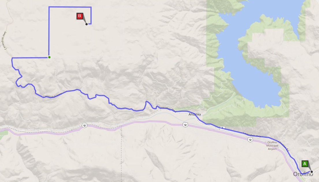
The event is located in north central Idaho. The closest town is Orofino. Note: Directions to Cavendish from most online maps (Yahoo, Google, Expedia) will get you lost. Do not use them to navigate past Orofino, Moscow, or Lewiston — use the directions below from those points.
If you travel by plane you might want to read this page on commercial air travel with firearms: Guns and Planes.
From the Seattle Area
Go east on I-90 to Vantage. Do NOT continue on I-90 to Spokane. At Vantage take Washington State Route 26 east to Colfax. From Colfax go south on US 195 toward Lewiston (and Moscow/Pullman). US 195 will become US 95 and take you to Lewiston. From Lewiston, get on eastbound US 12 and follow it to Orofino.
From Either Lewiston or Moscow
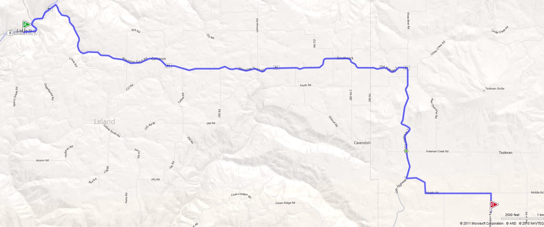
Go east and follow signs to Kendrick. Once in Kendrick, continue through town to the northeast (when coming in from Moscow take a left when you hit town). Watch for signs to Southwick, Dworshak Dam, and Cavendish.
Shortly after you leave Kendrick the main road takes a slight left up a hill — take the right turn toward Southwick on P1. Then about 0.3 miles further take another right (continuing on P1) across a bridge and up a steep hill.
After you pass Southwick the mile markers on P1 will start counting down when you enter Clearwater County. At the south end of Cavendish is mile marker 10, at the junction of P1 and “Middle Road”. Take a left (east) and follow Middle Road for about 2.5 miles to Meridian Road. Turn right (south) on this gravel road and go about 0.5 miles to the driveway-type road on the right. Take that right. About 200 yards ahead on your left will be the parking area.
Turn-by-Turn from Kendrick
Route: 18.8 miles, approx. 37 min via Old Highway 7 / CR-P1
- Depart SR-3 / E Main St toward 6th St — 1.1 mi
- Bear right onto Cedar Ridge Rd / CR-P — 10.4 mi
- Keep right to stay on Wauncher Gulch Rd / CR-P — 9.4 mi
- Keep left to stay on Wauncher Gulch Rd / CR-P — 14.9 mi
- Turn left onto Middle Rd / Teakean Rd — 2.6 mi
- Turn right onto Meridian Rd — 0.5 mi
- Arrive at shooting site on right